Dreaming of stepping out your back door to a trout-filled river in Etna or Alpine? You are not alone. Riverfront in Star Valley blends quiet privacy with world-class recreation, but these parcels come with unique variables. In this guide, you will learn the key checks that help you buy with confidence, from floodplain and access to permits, utilities, and water rights. Let’s dive in.
Know the river systems
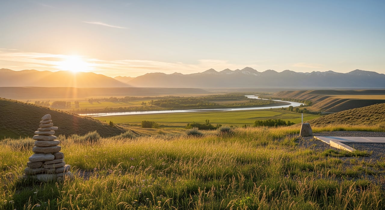
Etna and Alpine sit in Star Valley where the Salt River, Snake River, and smaller tributaries converge near Palisades Reservoir. River behavior here is shaped by spring snowmelt, upstream irrigation diversions, and reservoir operations. Levels can shift seasonally, which impacts access, bank stability, and recreation.
Ownership along the water in Wyoming is nuanced. The legal shoreline boundary on a given parcel may run to the mean high-water mark or to the thread of the stream. You should confirm the exact boundary in the deed and with a current survey. Also ask how public access is handled along the shore and whether any recorded easements affect your use.
Seasonal water levels
Expect higher flows in late spring as snowmelt moves through the system. Palisades Reservoir operations can influence nearby reaches, so water levels may change with upstream releases. In late summer, lower flows can affect boating access, while winter brings ice and fluctuating conditions along the banks.
These seasonal shifts are normal in Star Valley. They do, however, influence how you use the property, where you site improvements, and what kind of flood or erosion protections you consider.
Recreation and access
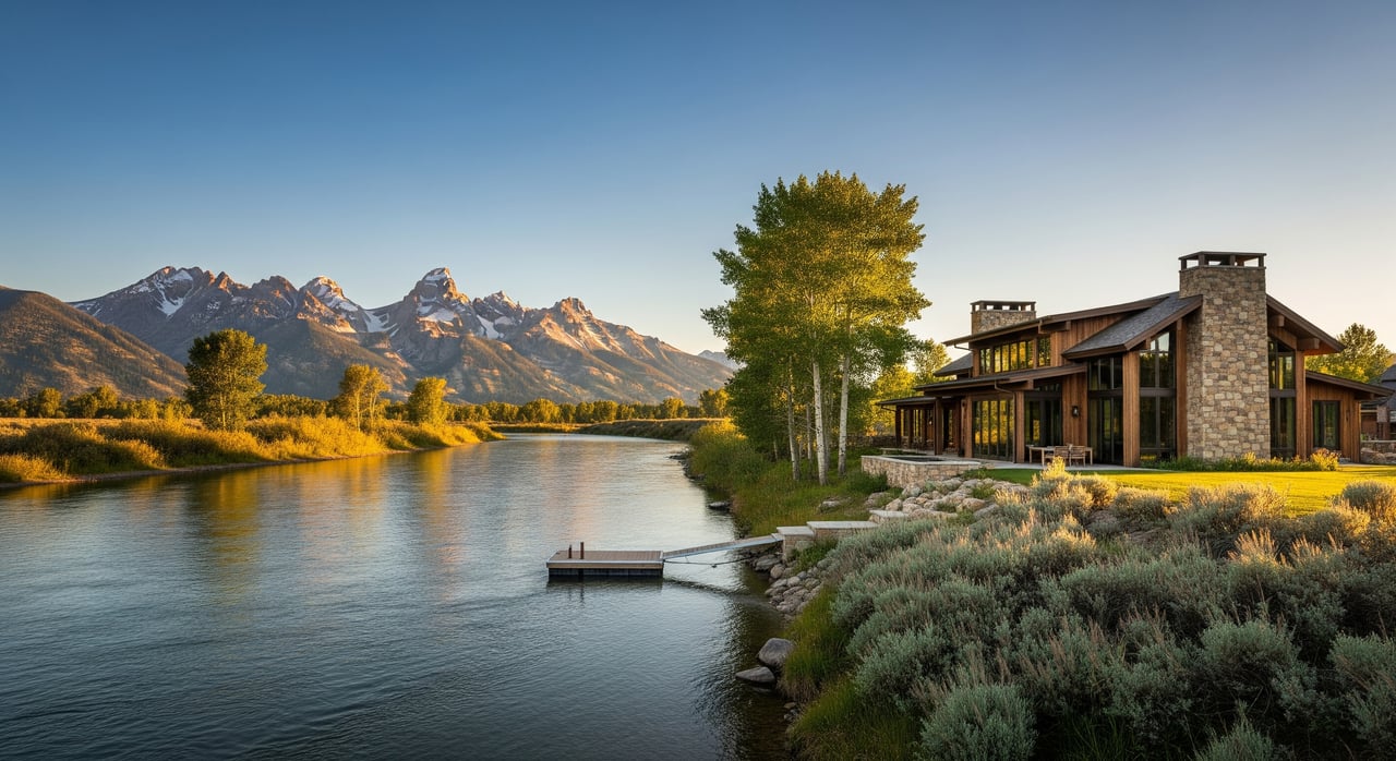
Most buyers come for the lifestyle. You will find fly fishing for cold-water trout, small-water floating by kayak or raft in the right reaches, shoreline picnicking, wildlife viewing, and winter skiing or snowshoeing. Reservoir-adjacent areas can support larger craft where allowed.
Confirm that the parcel has legal, recorded access to the road network and to the shore. Some roads are private or gated and may close seasonally. If you plan to launch bigger boats, make sure there is a practical public launch nearby and clarify any fees or restrictions. Also check local fishing and in-water rules. Species protections and regulation updates can limit bait types, seasons, or construction timing in the water.
Parcel layout and orientation
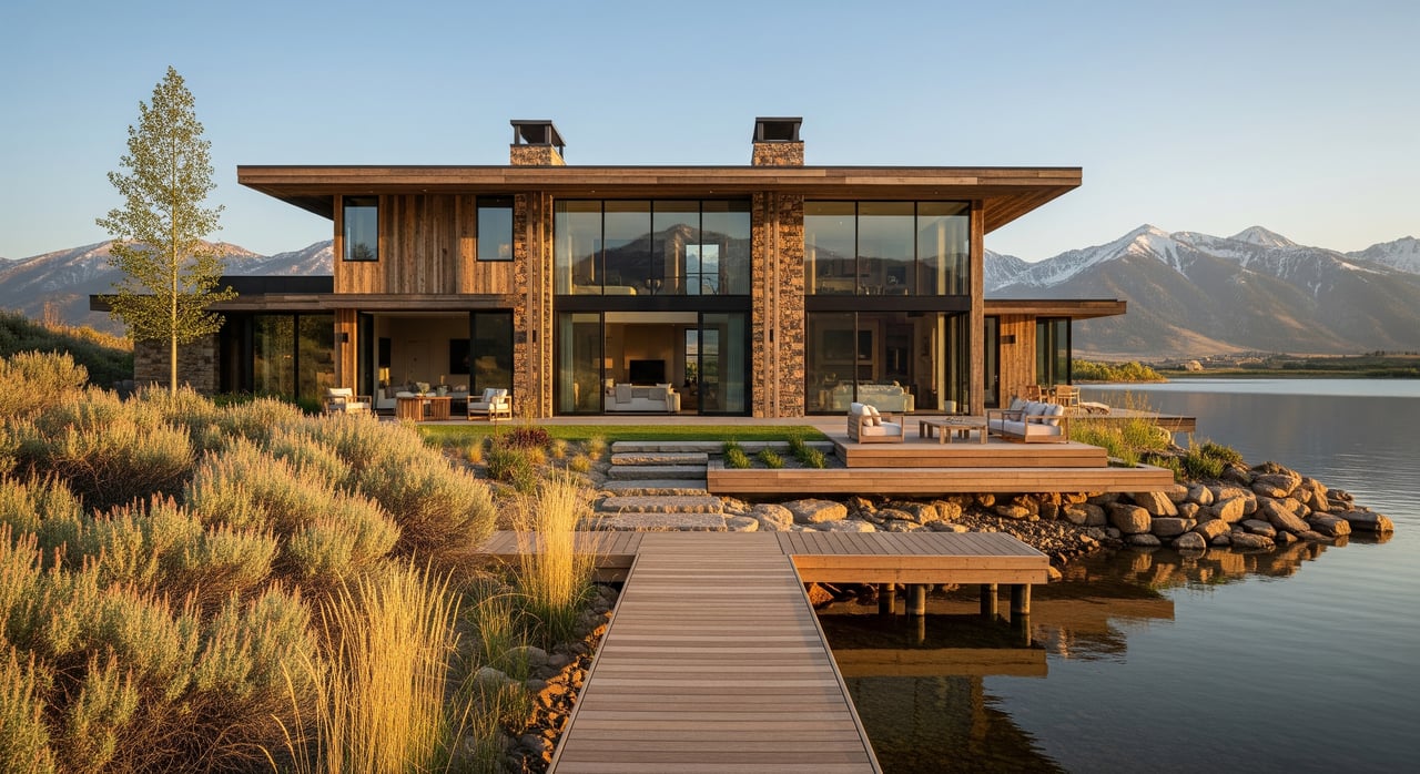
Riverfront parcels often run long and narrow along the water or sit as larger acreages with a defined frontage line. Subdivisions near town may share shoreline corridors. When you walk a lot, note how sun, wind, and views interact with the river corridor. Morning or evening light can feel very different depending on bank orientation and vegetation.
Riparian buffers are not just pretty, they are functional. Native vegetation stabilizes banks and supports fisheries. Plan on preserving or restoring these buffers. County or state rules may protect them, and they pay dividends in long-term stability.
Floodplain, banks, and setbacks
Many river-adjacent parcels in Star Valley map into FEMA flood zones. You will want to review floodplain maps and ask for any elevation certificate on file. Vertical separation between your finished floor and the base flood elevation can drive insurance cost, lending, and buildability.
Bank type matters. Bedrock or vegetated terraces behave differently than alluvial or artificially protected banks. During high flows, erodible banks can retreat. A trained eye can help you evaluate slope stability and future risk. Also confirm county or town shoreline, building, septic, well, and utility setbacks before you commit to a design.
Utilities and site services
Do not assume utilities are at the lot line. In rural stretches, you may need to extend electric or broadband at your cost. Water can be from a municipal source, a shared well, or an individual well. Ask for well permits and yield tests if applicable.
If the property needs a septic system, a current percolation test is essential. Rocky soils or high seasonal groundwater can limit your options. Clarify year-round services too, including snow removal responsibilities, trash collection, and whether roads are county maintained or private.
Permits, water rights, and rules
Any in-water or bank work, including docks or stabilization, often requires multiple approvals. You may need state stream alteration permissions, federal review under the Clean Water Act, and, for reservoir-adjacent parcels, permission from reservoir administrators. Start these conversations early if you plan shoreline improvements.
Check county zoning, overlays, permitted uses, density, and shoreline setbacks. If a parcel lies within Alpine town limits, confirm municipal rules and utility options. Short-term rental allowances vary by area, so verify if that is part of your plan.
Wyoming water rights follow prior appropriation. Surface water access is separate from land ownership. Ask whether any water rights transfer with the parcel and review records and priorities with the proper state office. If wetlands or protected habitat exist, a delineation and biological review may be required before development.
Title, surveys, and easements
In Wyoming, mineral rights may be severed from surface rights. A title search and commitment should spell out any mineral reservations, leases, or exceptions. Clarify recorded access easements, utility easements, and any conservation or HOA covenants that touch the shoreline or your building envelope.
An up-to-date boundary survey is critical on riverfront. It should confirm whether the deeded line runs to the high-water mark or to the thread of the stream. If the parcel is in or near a mapped flood zone, request or order an elevation certificate from a qualified surveyor or engineer.
Insurance and risk planning
Standard homeowners policies typically do not include flood coverage. Even outside mapped zones, you should consider flood insurance. If you are in a FEMA floodplain, program options are generally available and rates depend on elevation and community participation. An elevation certificate is often required for accurate quotes.
For parcels with steep or visibly eroding banks, budget for stabilization or consult a specialist. Wildfire exposure can exist on wooded or rural sites, so verify mitigation requirements and insurance availability before you finalize plans.
Inspections worth ordering
For higher-value or complex riverfront, specialized due diligence pays off. Consider:
- Boundary survey with recorded easements shown
- Elevation certificate for flood rating and siting
- Bank stability or hydrologic assessment to understand retreat and flood stages
- Percolation test and septic feasibility review
- Phase I environmental assessment on large or historically used sites
- Wetlands delineation and biological review near the stream corridor
- Legal review of riparian rights, easements, covenants, and mineral reservations
Smart offer contingencies
Strong offers still give you off-ramps if key items do not pencil out. Protect yourself with contingencies for:
- Utility availability and connection cost verification
- Septic percolation and well yield tests
- Acceptable flood insurance quotes
- Satisfactory survey confirming shoreline boundary and access easements
- Title review of mineral rights and recorded restrictions
- Any HOA or conservation rules that affect shoreline use or structures
What to ask on tour
Bring a focused checklist to each showing:
- Does the deeded boundary run to the high-water mark or the thread of the river?
- Is the parcel inside a FEMA-mapped flood zone? Is there an elevation certificate?
- Who provides electric, broadband, and garbage service, and where are connections?
- Is there a current percolation test and a permitted septic and well on site?
- Are any surface water rights included? Do upstream or downstream diversions affect flows?
- Is there existing bank stabilization, or planned public works nearby that could change hydraulics or access?
- Are there restrictions from conservation easements, HOA covenants, or reservoir easements that limit shoreline structures?
Who to call locally
When you get serious about a specific parcel, contact the right offices and specialists:
- Lincoln County Assessor or GIS for parcel maps, taxes, and current boundaries
- Lincoln County Planning and Zoning for zoning, setbacks, floodplain administration, and permits
- Town of Alpine if the parcel sits inside town limits for codes and utilities
- Lincoln County Public Health or environmental health for septic and well permitting
- Wyoming State Engineer’s Office for surface and groundwater rights records
- FEMA Flood Map Service Center for flood maps and community status
- U.S. Bureau of Reclamation for Palisades shoreline easements and reservoir operations on adjacent parcels
- U.S. Army Corps of Engineers for Clean Water Act Section 404 permitting on in-stream or bank work
- Wyoming Game and Fish Department for fishing rules and in-stream work restrictions
- Local fire district or county sheriff for emergency access and fire protection standards
- Local utility providers for service availability and extension costs
- Title company and a local real estate attorney for title, mineral rights, and easements
- Environmental and engineering specialists, including a hydrologist, surveyor, septic designer, and wetlands consultant
Work with a local expert
Buying riverfront in Etna or Alpine is as much about stewardship as it is about lifestyle. The right advisor helps you balance privacy, access, bank stability, and future build plans while navigating permits, surveys, and insurance. With senior-led guidance and concierge coordination, you can move from first tour to close with clarity.
If you are exploring riverfront in Star Valley, connect with a team that lives and works this corridor every day. Request a Private Consultation with DeMello & Co. to review listings, coordinate site walks, and structure a smart, contingency-backed offer.
FAQs
What makes Etna riverfront unique in Star Valley?
- Parcels are influenced by the Salt and Snake River systems and Palisades Reservoir, so seasonal flows, access, and bank conditions can change more than on typical non-river lots.
How risky is flooding for Etna and Alpine properties?
- Many river-adjacent parcels map into FEMA flood zones, so you should verify flood status, obtain an elevation certificate, and price flood insurance before you commit.
Can I build a dock or stabilize the bank near Palisades?
- Shoreline work often requires approvals from state regulators, the U.S. Army Corps of Engineers, and for reservoir-adjacent land, the Bureau of Reclamation. Start early and expect multi-agency review.
Do Wyoming riverfront parcels include water rights?
- Sometimes. Wyoming follows prior appropriation, so surface water rights are separate from land ownership. Confirm any rights and priorities with the proper state records before closing.
What utilities are typical on rural riverfront near Etna?
- Electric and broadband may require extensions, water can be municipal or from a shared or individual well, and septic is common. Verify providers and costs during due diligence.
How do mineral rights affect my purchase in Lincoln County?
- Mineral rights can be severed from the surface. A title search and attorney review should confirm any reservations or leases and how they might affect future surface use.